 Espace Collaboratif de Valorisation de l'Information Scientifique
Cartographic and topo-bathymetric archive dataset on the French Rhône River (1642-1946)
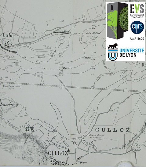
This dataset presents 350 cartographic and topo-bathymetric resources surveyed on the French Rhône River between 1642 and 1946. The dataset includes 330 maps and 93 topo-bathymetric data. Between 2017 and 2020, archive services poorly explored in previous programs have been consulted : French National Archives of Pierrefitte-sur-Seine, Bibliothèque nationale de France, Departmental Archives of Rhône, Ain and Gard. The dataset contains 3437 images.
Dataset updated to 02/05/2021.
Simple
- Date (Création)
- 2017-01-01T00:00:00
- Forme de la présentation
- Image numérique
- Contact pour la ressource
-
Nom de l'organisation Nom de la personne Adresse e-mail Rôle UMR 5600 EVS - ENS de Lyon
Fanny Arnaud
Point de contact UMR 5600 EVS - ENS de Lyon
Lalandy Sehen Chanu
Auteur
- Fréquence de mise à jour
- Lorsque nécessaire
- Thème
-
-
Historical map
-
Long profile
-
Cross-section
-
Channel changes
-
- Localisation
-
-
Rhône
-
OHM VR
-
OSR
-
- Limitation d'utilisation
-
Mention on all distribution media: "This work was supported by the LabEx DRIIHM and the OHM Vallée du Rhône".
- Limitation d'utilisation
-
Direct or indirect commercial use prohibited.
- Contraintes d'accès
- Droit de propriété intellectuelle / Droit patrimonial
- Contraintes d'accès
- Licence
- Restrictions de manipulation
- Non classifié
- Identificateur du jeu de données aggrégé
- 1c309cd1-2082-411c-9f4b-eee95edd4b1f
- Type d'association
- Partie d'une même base de données
- Type d'initiative
- Projet
- Dénominateur de l'échelle
- 10000
- Langue de la ressource
-
eng
- Encodage des caractères
- Utf8
- Catégorie ISO
-
- Carte de référence de la couverture terrestre
- Altimétrie
- Description
-
French Rhône River
))
- Date de début
- 1642-01-01
- Date de fin
- 1946-12-31
- Informations supplémentaires
-
Project OHM VR “Collection and visualization of historical biophysical resources on the Rhône River” (2017). Collaborators : G. Carrel (INRAE), J.M. Olivier (LEHNA), D. Roux-Michollet (GRAIE), A. Antonio, F. Arnaud (EVS). Actions D3 and D4 OSR5 (2018-2020).
- Nom du système de référence
- WGS84
- Format (encodage)
-
Nom Version JPG
2017
- Ressource en ligne
-
Protocole Adresse Internet Nom WWW:LINK-1.0-http--link
https://essd.copernicus.org/articles/13/1939/2021/essd-13-1939-2021-discussion.html Arnaud et al., 2021
WWW:LINK-1.0-http--link https://doi.pangaea.de/10.1594/PANGAEA.922437 WWW:LINK-1.0-http--link
https://ohm-vallee-du-rhone.fr/ OHM VR
WWW:LINK-1.0-http--link
https://websig.ens-lyon.fr/portal/apps/experiencebuilder/experience/?id=957248d67f9341dd9d34e7fc49e6d45f GéoRhône
WWW:LINK-1.0-http--link
http://photo.driihm.fr/index.php?/category/52 Photo-DRIIHM
WWW:LINK-1.0-http--link
https://observatoire-sediments-rhone.fr/ OSR
- Niveau
- Jeu de données
Résultat de conformité
- Titre
-
COMMISSION REGULATION (EU) No 1089/2010 of 23 November 2010 implementing Directive 2007/2/EC of the European Parliament and of the Council as regards interoperability of spatial data sets and services
- Date (Publication)
- 2013-10-21
- Explication
-
Not evaluated
- Généralités sur la provenance
-
See the PANGAEA dataset deposit and Arnaud et al., 2021 published in Earth System Science Data for further details on material and methods.
Métadonnées
- Identifiant de la fiche
- 6b60389a-92da-4353-b4d9-9280d0638f5f XML
- Langue
-
fre
- Jeu de caractères
- Utf8
- Type de ressource
- Jeu de données
- Date des métadonnées
- 2026-02-25T10:53:54.876979Z
- Nom du standard de métadonnées
-
ISO 19115:2003/19139
- Version du standard de métadonnées
-
1.0
- Contact
-
Nom de l'organisation Nom de la personne Adresse e-mail Rôle UMR 5600 EVS - ENS de Lyon
Fanny Arnaud
Point de contact
)))